ALPHA8/1M/FMEF/S/S/11
Part Number : ALPHA8/1M/FMEF/S/S/11
SirettaBLADE ANTENNA, 1.71-1.99GHZ, 2DBI;

TANGO16/7M/SMAM/SMAM/S/S/26
Part Number : TANGO16/7M/SMAM/SMAM/S/S/26
SirettaCOMBO ANTENNA, 1.71-2.17GHZ, 2DBI;

TANGO421/1.5M/SMAM/SMAM/S/S/29
Part Number : TANGO421/1.5M/SMAM/SMAM/S/S/29
SirettaANTENNA, CELLULAR/LTE, 2.7GHZ, 6DB;
QUARTZ-W22-LTE(EU) + ACC
Part Number : QUARTZ-W22-LTE(EU) + ACC
SirettaRouters QUARTZ 4G/3G EU FREQ WITH 2 LAN/ 2 SIM / WIFI / RS232 / 3DIO + ACCESSORIES

OSCAR63/X/NTYPEF/S/29
Part Number : OSCAR63/X/NTYPEF/S/29
SirettaRf Antenna, 7.392 To 7.92 Ghz, 8.38Dbi Rohs Compliant: Yes |Siretta OSCAR63/X/NTYPEF/S/29
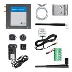
ZETA-N-LTE(EU) STARTER KIT
Part Number : ZETA-N-LTE(EU) STARTER KIT
SirettaINDUSTRIAL MODEM W/GPIO, LTE, RS232/USB
QUARTZ-W22-LTE(EU) + ACC
Part Number : QUARTZ-W22-LTE(EU) + ACC
SirettaRouters QUARTZ 4G/3G EU FREQ WITH 2 LAN/ 2 SIM / WIFI / RS232 / 3DIO + ACCESSORIES
QUARTZ-W22-LTE(EU) + ACC
Part Number : QUARTZ-W22-LTE(EU) + ACC
SirettaRouters QUARTZ 4G/3G EU FREQ WITH 2 LAN/ 2 SIM / WIFI / RS232 / 3DIO + ACCESSORIES
QUARTZ-W22-LTE(EU) + ACC
Part Number : QUARTZ-W22-LTE(EU) + ACC
SirettaRouters QUARTZ 4G/3G EU FREQ WITH 2 LAN/ 2 SIM / WIFI / RS232 / 3DIO + ACCESSORIES

SNYPER-LTE+ SPECTRUM (EU) V2
Part Number : SNYPER-LTE+ SPECTRUM (EU) V2
SirettaSIGNAL STRENGTH TESTER: 4G/3G/2G EU ROHS COMPLIANT: YES
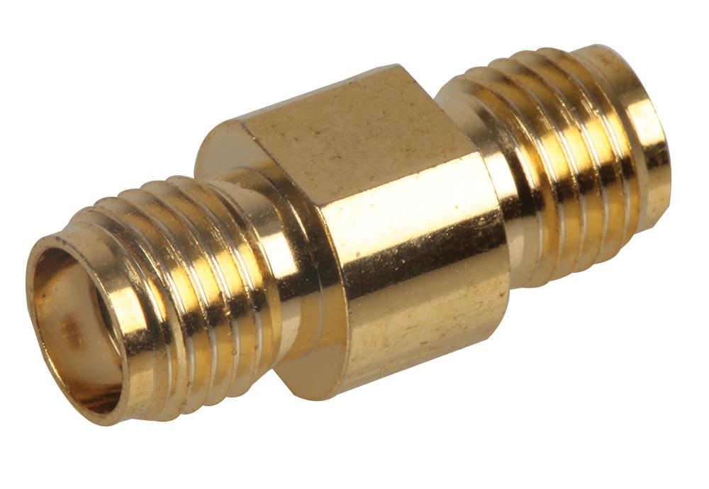
ADAPT/SMAF/SMAF (GOLD)
Part Number : ADAPT/SMAF/SMAF (GOLD)
SirettaRf Coax Adapter, Sma Jack-Sma Jack; Convert From Coax Type:Sma; Convert From Gender:Jack; Convert To Coax Type:Sma; Convert To Gender:Jack; Adapter Body Style:Straight Adapter; Impedance:-; Connector Type:Intra Series Coaxial; Rohs Compliant: Yes |Siretta ADAPT/SMAF/SMAF (GOLD)
SNYPER-IOT GRAPHYTE (GL)
Part Number : SNYPER-IOT GRAPHYTE (GL)
SirettaSnyper-Iot Graphyte Nw Signal Analyser |Siretta SNYPER-IOT GRAPHYTE (GL)

QUARTZ-ONYX-W42-5G (GL) WITH ACCESSORIES
Part Number : QUARTZ-ONYX-W42-5G (GL) WITH ACCESSORIES
SirettaROUTER, 5G, 4 X LAN, DUAL SIM, 12VDC;